Boxgrove Parish Council
BOXGROVE PARISH COUNCIL
  • Home
  • The Parish Council
    Boxgrove Parish Council Accessibility Statement Agendas and Minutes Councillors Data Protection Emergency Contact Details Financials Freedom of Information Meeting Dates Privacy Strategic, Governance and Finance Documents
  • About Boxgrove
    Our Parish Listed Buildings Conservation Areas
  • Visit Boxgrove
    Local Attractions The Priory Church The Priory Halnaker Windmill
  • Contact Us
    How to contact us
  • I want to ...
    Find my District Councillor Find My MP Report a Highway problem Report an Abandoned Vehicle Register a death Report Flytipping Find my County Councillor
  • Public Maps
    Conservation Areas Public Rights of Way Listed Buildings Tree Preservation Orders Historic Environment Records Priority Habitat Inventory Significant Views Local Green Space and Local Open Space Biodiversity Corridors Important Views and Vistas Non-designated Heritage Assets Scheduled Ancient Monuments SSSI's Flood Risk Barn Owl, Bat and Water Vole Networks Surface Water Flooding
  • Boxgrove News
  • A to Z

Conservation Areas

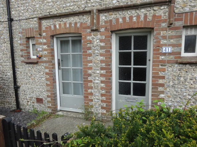
The parish has two Conservation Areas both of which have Character Appraisal and Management Proposal documents which set out management proposals to ensure the preservation and enhancement of the Conservation Areas for future generations.

https://www.chichester.gov.uk/media/10785/Boxgrove-Conservation-Area-Appraisal-and-Management-Proposals/pdf/Boxgrove_CA_02-09-10.pdf

https://www.chichester.gov.uk/media/9367/Boxgrove-Townscape-Analysis-Map/pdf/Boxgrove_TAM_01-04-10.pdf

https://www.chichester.gov.uk/media/10792/Halnaker-Conservation-Area-Appraisal-and-Management-Proposals/pdf/Halnaker_CA_21-09-10.pdf

https://www.chichester.gov.uk/media/9370/Halnaker-Conservation-Area---Townscape-Analysis-map/pdf/Halnaker_TAM_26-04-10.pdf

https://www.chichester.gov.uk/media/9575/Halnaker-Approved-Conservation-Area-extension---Townscape-Analysis-Map/pdf/Halnaker_Proposed_Extension_TAM_26-04-10__2.pdf


To view maps of the Conservation Area boundaries follow the link. 

Related Topics

Listed Buildings

Latest News
Free Charity SORP seminar 26th November
28 October 2025

The Sussex Police and Crime Commissioner Latest Update
24 October 2025

You Can't Control the Weather. You can be Prepared
24 October 2025

Temporary closure of Shripney Road 12th November 2025 overnight for 5 days
24 October 2025

Tackling flood risk, check your blood pressure for free, job seekers support, and more!
17 October 2025


Planning Application

Land At Temple Bar Junction, Chichester , West Sussex, PO18 0PF

Outline application some matters reserved except Access and Landscaping - construction of industrial/warehousing floorspace (Use Class B2/B8) with ancillary office accommodation, associated car parking provision, utilities and other infrastructure, green infrastructure, landscaping and highway works.


Designed and built by JNR Computer Services © Boxgrove PC 2023 All rights reserved.

Privacy l Data Protection l Freedom of Information l Accessibility Statement

Civility and Respect Badge

Cookies on this website

We use some essential cookies to make this service work.

We’d also like to use analytics cookies so we can understand how you use the service and make improvements.

View cookies

You’ve accepted analytics cookies. You can change your settings at any time.

You’ve rejected analytics cookies. You can change your settings at any time.

Cookie settings

Essential cookies

These cookies are required to make the service work and cannot be turned off.

Analytics cookies

We use analytics to improve the service. Turn these on or off below.

Analytics cookies preference Choose whether to allow analytics cookies.